Permanent survey marks (PSMs) are major reference marks placed by surveyors to identify property boundaries.
PSMs must not be disturbed without approval of the Surveyor-General. Fines of up to $2000 per PSM can be applied if they are:
- disturbed
- damaged
- moved or removed
- destroyed.
Protecting land boundaries after a bushfire
Damage and destruction commonly occurs when:
- constructing driveways, roads, footpaths and pram ramps
- building fences
- landscaping
- installing underground services.
PSMs must remain accessible. By law, surveyors can break any surface to locate a marker, including driveways, footpaths and landscaped areas.
Email DHUD.SurveyOperations@sa.gov.au before starting any ground work to locate a PSM.
How to find a PSM
Metro areas
PSMs are shown on survey plans with references to the boundary corner but do not mark the boundary corner.
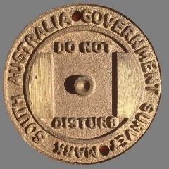
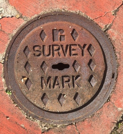
They are made of concrete blocks, approximately 200 mm square and 300 mm deep with a brass plaque or metal rod at the centre.
Most PSMs are situated below ground level and are not easily identifiable. In urban areas, they may be covered with a steel lid.
Rural areas
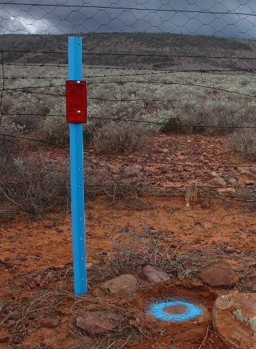
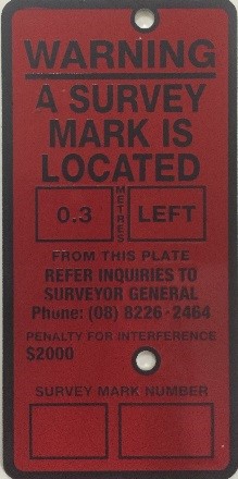
PSMs are often marked with a blue star dropper and red indicator plate in rural areas.
In the Riverland, many PSMs are concrete pillars 400 mm above ground level. This makes them easier to locate.
Areas being developed
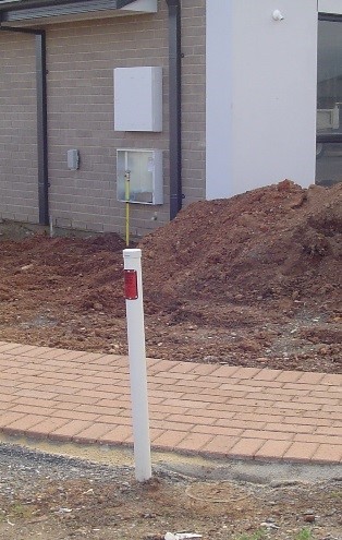
PSMs are usually marked with a white PVC post and red indicator plate with the location of the buried PSM shown on the red plate in areas being developed.
There are no definite rules about where they are placed:
- In urban areas, they are usually placed in footpaths near street corners, bends or next to the back of a kerb.
- In rural areas, they are usually located in the road reserve, next to fencing at prominent road bends or intersections. Occasionally, they are located on private property
Finding a survey mark
Approximate locations can be found from the Survey Mark dataset of the SA Property and Planning Atlas. Search for horizontal coordinates, elevation and survey plans.
Contact the Surveyor-General’s Office
Email: DHUD.SurveyOperations@sa.gov.au
Phone: (08) 7133 2300